Itinerary:
When To Go & Why The
Grand Enchantment Trail features a wide diversity of elevation and climate. Lowland
desert areas tend to remain relatively mild throughout the winter, a time of year
when the highest terrain along the route sometimes see bitter cold and deep snowpack.
By late spring, these same mountain heights offer a cool and pleasant retreat
from the furnace-like heat of the arid deserts below. Summer brings monsoon rains
to the entire region, often with violent thunderstorms and frequent lightning.
Moderate temperatures prevail throughout the region in autumn, although this season
can also be quite dry.
As
on other long-distance trails, there is no such thing as an all-around "perfect"
hiking season on the G.E.T. Although it is certainly possible to plan a hike that
avoids climatic extremes, the long-distance game always requires a trade-off somewhere.
On our route, the trade-off for a milder desert is a snowy summit and lively creek,
or a drier hike with shorter days. It's a worthwhile trade-off, in most cases,
since a majority of the route is desert or semi-arid, and when it's extremely
hot here the hiking can become far less enjoyable.
Season
and Direction of Travel
To
avoid seasonal extremes, thru-hikers should plan to travel the 700+ mile route
in either spring or autumn. As a rule, summer is much too warm for prolonged
desert travel, while winter in the high country, including a fair portion of the
route in New Mexico, tends to be cold and frequently snowbound, the latter making
routefinding infinitely more challenging. Thru-hiking in the June-August
or December-February timeframe is simply beyond the scope of this planning material
and guidebook. We don't advise it, nor do we offer any counsel on such a trip.
Of spring
and autumn, each season presents its pros and cons to the aspiring thru-hiker,
and each offers a different perspective of the land and its weather, flora, and
fauna. Direction of travel is likewise influenced by the season you choose to
hike.
Eastbound
in Spring
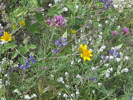 |
| A
Desert No More: Wet Spring in the Sonoran |
A
spring season thru-hike offers the advantages of ample drinking water (following
a winter of average moisture), more hours of available daylight, and a chance
to see the desert in bloom - which in particularly wet years can be spectacular.
The highest elevations along the route can still harbor some snowpack, however.
And a few creeks and rivers may be running quick and high with snowmelt. Negotiating
snowpack and fording creeks can occasionally pose enough challenge that you would
need to follow a detour around these obstacles, meaning that your hike might be
a bit longer and perhaps not quite as ideal. That said, not every spring in this
part of the country presents mountain snowpack concerns or high meltwater runoff.
And it is both possible and desirable to adjust your itinerary to the seasonal
conditions at hand.
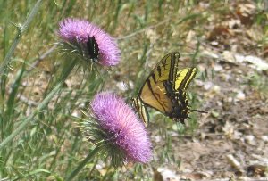 |
| Thistle
in bloom, Aravaipa Canyon |
Springtime
thru-hikers would follow the G.E.T. eastbound from Phoenix to Albuquerque.
This approach lets you traverse the most torrid regions before they really heat
up, while it delays your arrival in the higher terrain of New Mexico until later
in spring when conditions are generally more favorable. Begin at Phoenix between
March 10 and April 10, choosing an early-side start date in years of lower regional
mountain snowpack, or a later-side start in heavier snow years. Finish at Albuquerque
by the end of May in order to thwart the full broil of summertime heat and sun.
See
the Planner sections on weather, water, snowpack, and creek fording for further
information on what to expect in spring.
Westbound
in Autumn
Fall
is generally a wonderful time of year for hiking, and this holds true in the Southwest
as well. The sun is lower in the sky and less intense than in spring. Temperatures
in the desert are beginning to moderate again, and in the mountains the air is
dry and crisp, with the fall color of aspens on display. What's more, any spring
snowpack is long gone by autumn, and most creeks run lower and gentler.
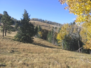
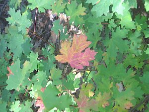 |
| Maple
forest, Canon Tajique NM |
Sounds
genuinely ideal, right? And a fall trek certainly can be. But before you commit
to this season, first consider its unique challenges. For one, some water sources
- particularly small mountain creeks - are snowmelt dependent, and may not be
reliable once the spring snowpack is gone. Too, all drinking water along the route,
to greater or lesser degrees, is dependent upon precipitation patterns, and autumn
is usually a dry season in the Southwest. Summer rains may or may not be abundant,
and their effects may or may not linger into fall. The upshot is that, on average,
an autumn thru-hike will feature fewer available water sources, so you will need
to carry more of the wet stuff over greater distances.
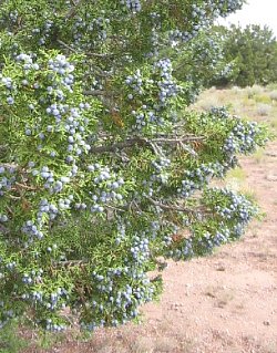 |
| Juniper
berries near La Jencia Creek, New Mexico; edible pinyon pine nuts also ripen in
fall of some years |
Temperatures
can be another concern. Specifically, overnight temperatures in the high country
often approach or drop below the freezing mark by autumn, meaning you might need
to carry a heavier sleeping bag and more clothing than in spring. And even though
fall tends to be a dry season, early snowstorms can occasionally hit the highest
terrain in October, potentially slowing you down or necessitating a detour. Don't
discount autumn's shorter days, either - they can noticeably decrease your daily
mileage as the hike progresses, especially since night hiking isn't always feasible
on a route that requires your attention. Trailside growth can be more lavish at
this time of year, too, as can burrs and other stickers.
In
fall, thru-hikers would begin in Albuquerque and travel westward toward Phoenix.
Since the G.E.T. in New Mexico is, on average, higher and cooler than Arizona,
this direction of travel decreases your exposure to the chilliest weather, while
it finds you arriving in the lowest terrain later in autumn when the desert is
milder. Begin at Albuquerque sometime between the 5th and 20th of September, or
generally just after the summer monsoon pattern has diminished. Finish near Phoenix
before the end of November to minimize the risk of early winter storms in the
higher terrain of Arizona.
See
the Planner sections on weather, water, and creek fording for more information
on fall season hiking
 |
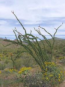
| Yin
& Yang: ocotillo and brittlebush blossom in spring, Sonoran desert (left);
aspens aflame at 10k in fall, Mogollon Mtns (above) |